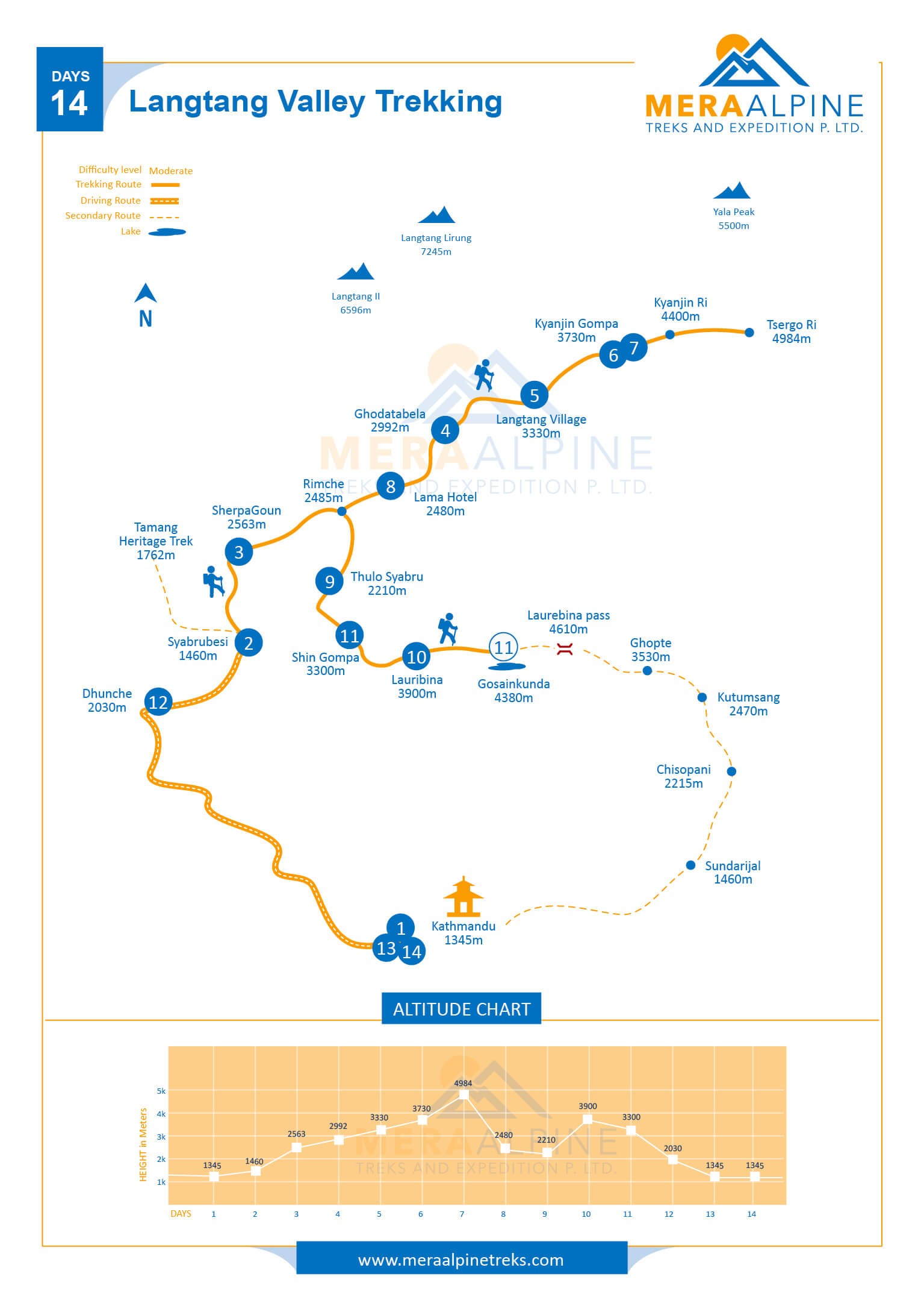
Langtang Gosaikunda Trekking Map will present you pictorial view of the route that you will follow during your Langtang Valley trek with us. Langtang Valley is situated at the foot of the Himalayas to the north of the Kathmandu Valley and bordering Tibet. Langtang region also includes the Langtang National Park, which is also home to some of the endangered animals. Langtang Valley Trek Map includes drive from Kathmandu to Syabru Bensi. From Syabru Bensi, you will trek to Sherpa Gaon and move towards Langtang Village via Ghoda Tabela. The trail then take you to ancient Kyanjin Gompa. You will then hike to Tsergo Ri or Kyanjin Ri to witness gorgeous scenery. Further, you will trek and reach holy Gosaikunda Lake en rout Lama Hotel, Thulo Syabru & Laurebina. Leaving Gosaikunda behind, you will descend down to Dhunche and drive back to Kathmandu.